Can SOMAG Gyro Stabilization Mounts Be Used in Helicopters? Here Is the Proof!
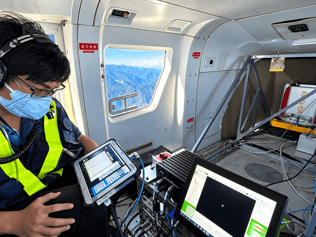
High mountains, deep valleys and rapidly changing weather make aerial surveying a demanding task. For RealWorld Surveying and Geomatics Corp., these conditions are part of everyday airborne mapping operations in Taiwan.
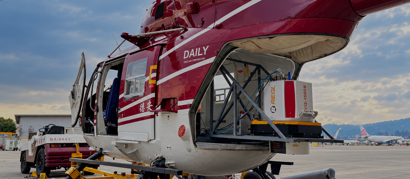
Using a SOMAG GSM 4000 Gyro Stabilization Mount aboard a Kawasaki/MBB BK117 B-2 helicopter, RealWorld combines airborne LiDAR and high-resolution aerial imagery to capture mountainous terrain.
The customer’s operational experience and the recorded stabilization data demonstrate how the GSM 4000 maintains precise sensor alignment in this helicopter installation—even while substantial compensation movements are required.
With residual sensor motion of approximately 0.03° RMS in pitch and below 0.05° RMS in roll in the detailed flight example, this application provides measurable evidence of the GSM 4000’s performance in demanding helicopter-based LiDAR surveying.
Mapping High Mountains and Deep Valleys
RealWorld’s survey area is characterized by steep terrain, dense vegetation and elevation differences exceeding 2,000 metres. Strong winds in the mountains add to the challenges of maintaining consistent acquisition conditions.
Weather also places considerable pressure on mission planning. According to RealWorld, suitable conditions can disappear quickly, and the next opportunity to collect data may not arrive for more than two weeks.
A successful flight therefore needs to deliver more than completed flight lines: it needs to produce usable, consistent survey data.
For the team, stabilization is an important part of making those limited acquisition windows count. By keeping the sensor package aligned during flight, the GSM 4000 supports the acquisition geometry on which the planned airborne mapping workflow depends.
This is particularly important for helicopter-based aerial surveying. Aircraft attitude changes caused by turbulence, mountain winds and maneuvering can affect the orientation of airborne sensors. At the same time, rotor-induced vibrations introduce additional disturbances that must be controlled during data acquisition.
For RealWorld, reliable sensor stabilization therefore contributes directly to the consistency and efficiency of its mapping operations.
One Stabilized Platform for Airborne LiDAR and Aerial Imagery
RealWorld’s helicopter installation combines laser scanning, aerial photography and flight-management software in a single mapping setup.
| Component | Equipment Used |
|---|---|
| Survey company | RealWorld Surveying and Geomatics Corp., Taiwan |
| Helicopter | Kawasaki/MBB BK117 B-2 |
| Helicopter operator | Daily Air Corporation, Taiwan |
| LiDAR system | RIEGL VQ-1560 II |
| Integrated aerial camera | Phase One iXU-RS1000, 100 megapixels |
| Mission planning and flight management | TOPOFLIGHT MISSIONPLANNER and NAVIGATOR |
| Gyro Stabilization Mount | GSM 4000 |
| Configuration supplied by RealWorld. |
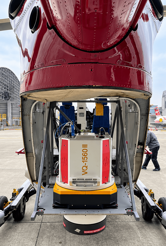
The LiDAR and integrated camera share the stabilized platform. TOPOFLIGHT MISSIONPLANNER supports the preparation of the survey, while NAVIGATOR provides flight-management and sensor-control functions during acquisition.
RealWorld particularly values the ability to maintain the planned sensor heading and camera kappa orientation.
Keeping the acquisition direction consistent with the flight plan helps the team preserve the intended relationship between flight lines, imagery and LiDAR coverage.
This is an important consideration when combining airborne laser scanning and aerial photography. Both sensors depend on predictable acquisition geometry, while the final mapping products must be generated from data collected under changing flight conditions.
The SOMAG GSM 4000 supports this process by compensating for aircraft movements and helping maintain the intended orientation of the integrated sensor package.
Addressing Attitude Changes and Vibration
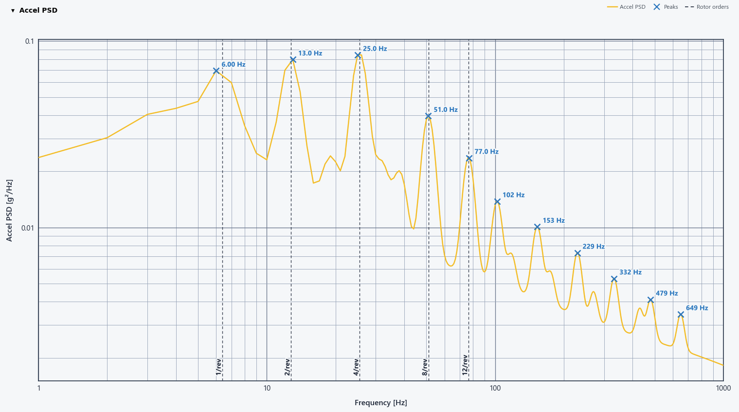
The spectrum is based on the actual flight data. The spectra show the characteristic behavior of a helicopter platform: dominant excitation in the low-frequency range, a clearly visible contribution around the main rotor frequency (~1/rev, approx. 6.4 Hz), and pronounced higher-order components around the blade-passage frequency (~4/rev, approx. 25.5 Hz) and its harmonics such as 8/rev and 12/rev.
This is exactly where the SOMAG stabilization and vibration-isolation concept become critical. In a helicopter application, the sensor is not only affected by slower aircraft attitude changes caused by turbulence, wind and maneuvering, but also by continuous rotor-induced vibration over a broad frequency range. The passive SOMAG vibration isolation helps decouple the LiDAR and camera system from these higher-frequency structural vibrations, while the general motion compensation of the GSM 4000 keeps the sensor orientation stable despite roll and pitch movements of the aircraft. Together, both mechanisms ensure that the excitation seen at aircraft level is not transferred directly into the sensor data.
Without this isolation and compensation, the helicopter motion would act directly on the LiDAR and camera system. In practice, this would lead to significantly stronger angular disturbances, reduced pointing stability and a clear deterioration of the mapping results. Typical effects would include increased strip misalignment, reduced point-cloud consistency, degraded absolute and relative accuracy, more noise in the elevation data, and visible artefacts in terrain models, especially in challenging mountainous terrain. For the integrated camera, one would also expect a less stable acquisition geometry and therefore less consistent image orientation. In short: without SOMAG, the helicopter’s vibration and motion would become visible in the data; with SOMAG, they are effectively controlled before they can compromise the mission result.
Sensor Motion Reduced to Hundredths of a Degree
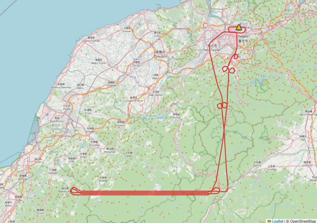
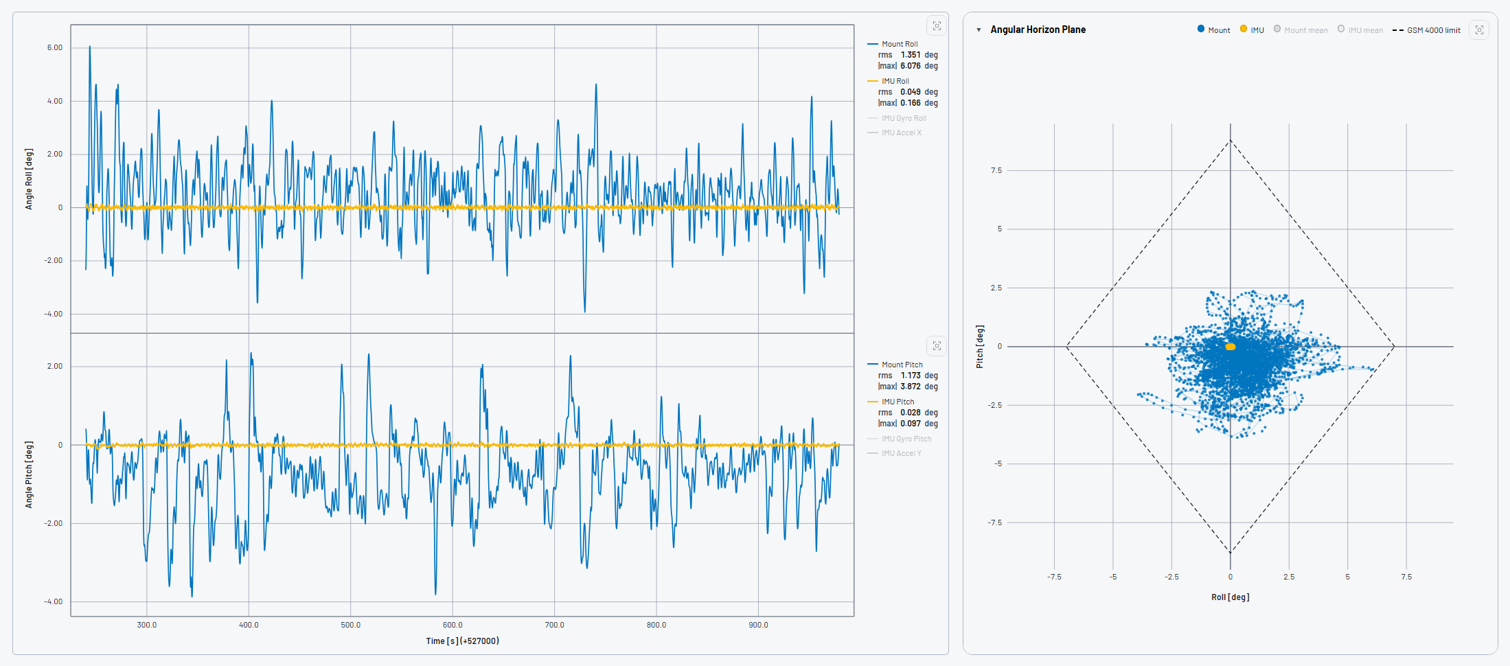
Precise stabilization, even under demanding helicopter flight conditions. The evaluation of four survey flight lines demonstrates how effectively the SOMAG GSM 4000 compensates for aircraft movements. In flight line 2, the mount responds to angular movements of several degrees, while the sensor itself remains closely aligned with its reference orientation.
The results speak for themselves: residual sensor motion of approximately 0.03° RMS in pitch and less than 0.05° RMS in roll during the evaluated segment. These measurements demonstrate the GSM 4000’s ability to maintain highly stable sensor orientation despite the movements of the helicopter.
And just as importantly, the GSM 4000 maintained sufficient compensation travel throughout all four evaluated flight lines. The mount never reached its mechanical end stops, even though it approached its movement limits at times.
From Stable Acquisition to Detailed Mapping Products
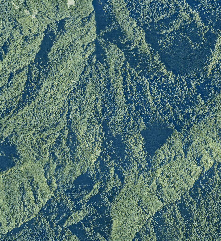
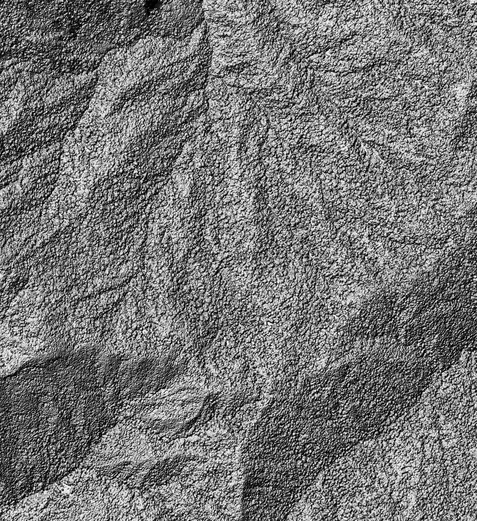
Aerial Imagery
High-resolution aerial imagery captures the forest canopy and visible landscape features across the mountainous survey area.
Digital Surface Model
The LiDAR-derived digital surface model reveals the three-dimensional structure of the terrain and vegetation surface.
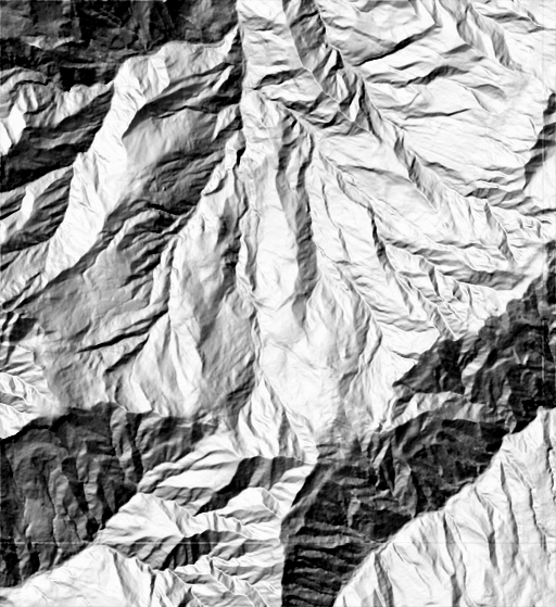
Shaded Elevation Model
A shaded elevation view highlights ridges, valleys and terrain features that are less apparent in conventional aerial imagery.
Trust Somag

For RealWorld, the value of the stabilization platform extends beyond the recorded angular performance.
The team highlights compatibility with established sensor manufacturers—including RIEGL, Vexcel and Phase One—as an important consideration when investing in equipment. The ability to use SOMAG solutions in both fixed-wing aircraft and helicopters also provides flexibility across different mapping applications.
Practical accessibility matters, too. RealWorld reports that the external pneumatic support arrangement in its installation allows the camera lenses to be accessed from inside the aircraft, simplifying maintenance. The team also values the fast response of the hydraulic stabilization system.
About RealWorld Surveying and Geomatics Corp.
Founded in 1974, RealWorld Surveying and Geomatics Corp. is a Taiwan-based provider of surveying, mapping and geospatial services. The company supports public-sector and engineering projects with expertise in spatial data acquisition, processing and analysis, including airborne mapping applications.
About SOMAG AG Jena
SOMAG is a Germany-based specialist in high-precision Gyro Stabilization Mounts. Since 2004, the company has developed and manufactured stabilization systems for airborne, land-based and maritime applications. SOMAG solutions compensate for platform movements to support stable sensor orientation and high-quality data acquisition.
Next-Level Stabilization.
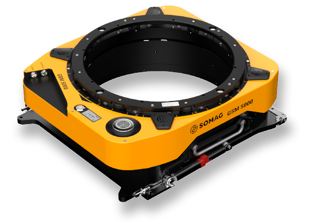
RealWorld’s helicopter mapping mission demonstrates the stabilization capabilities of the SOMAG GSM 4000 under demanding flight conditions. Building on this proven technology, its successor, the GSM 5000, offers an expanded compensation range in roll, pitch and drift—providing additional flexibility for future airborne mapping applications.