
SOMAG at Euronaval 2026

-- archive.php --

Advanced Stabilization for Mission-Critical Maritime Systems

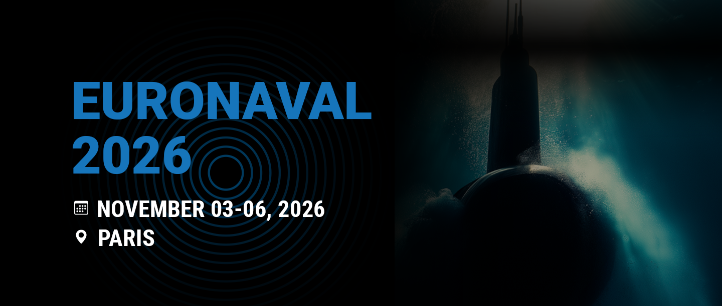
SOMAG AG Jena will be exhibiting at EURONAVAL 2026, one of the world’s leading exhibitions for naval defence and maritime security.

We look forward to welcoming visitors, customers and industry partners at booth L43 on November 3-6, 2026. At our stand, we will present our portfolio of high-precision Marine Gyro Stabilization Mounts for demanding maritime applications.

Reliable stabilization for maritime sensor systems

SOMAG develops and manufactures stabilization solutions for applications in the air, on land and at sea. Our Gyro Stabilization Mounts compensate for the angular motion of moving platforms and help sensors deliver reliable and high-quality data even under challenging operational conditions.

For maritime and naval applications, stabilized sensor systems can make a decisive contribution to situational awareness, surveillance, reconnaissance, search and rescue operations and other mission-critical tasks.

Our stabilization platforms can be used with a wide range of payloads, including:

  • EO/IR and PTZ camera systems
  • radar systems
  • laser scanners
  • antennas
  • scientific and surveillance sensors
  • customer-specific sensor combinations

Meet our stabilization experts

Sören Lieske
Sales Manager

Sales Airborne, Marine, Land
Phone: +49 3641 633 68 18
E-Mail: s.lieske@somag-ag.de
Let’s connect on LinkedIn

Sebastian Schreiber
CTO

Key Account Management
Phone: +49 3641 633 68 0
E-Mail: s.schreiber@somag-ag.de
Let’s connect on LinkedIn

Are you planning to integrate a sensor system on a ship, patrol vessel, unmanned surface vehicle or another moving maritime platform?

Our experts will be available throughout EURONAVAL 2026 to discuss your application, technical requirements and integration options. We will be pleased to help you identify a suitable stabilization solution or evaluate the feasibility of a customized system.

Schedule an appointment with our team in advance and visit us at booth L43.

We look forward to meeting you at EURONAVAL 2026!

    Contact us

    Book an appointment with our team at the event.
    We’re looking forward to seeing you!


    Please solve the following question:

    Because pin-sharp pictures need stabilization

    SOMAG AG Jena will participate in the 7th edition of the Open Day Photogrammetry at Dessau Airport / Technikmuseum Hugo-Junkers on September 29 and 30, 2026.

    Our CEO Andreas Steps and our Marketing coordinator Sophie Rudolph is looking forward to meet you at this special branch event and welcoming you at our booth.

    The Open Day Photogrammetry is an annual event that offers interested professionals a comprehensive insight into photogrammetric technologies. Under the motto ‘hands-on photogrammetry’, exclusive insights into aerial image-based surveying are provided. Look behind the scenes and find out first-hand how modern photogrammetry works. Deepen your knowledge in practical sessions on image processing, flight preparation and survey flights. Or familiarize yourself with the latest production processes and test innovative hardware and software on site. In direct dialogue, you can make contacts with manufacturers and experts and expand your network. The registration is now open.

    Meet our experts

    Andreas Steps
    CEO
    Phone: +49 3641 633 68 12
    E-Mail: a.steps@somag-ag.de
    Let’s connect on LinkedIn

    Sophie Rudolph
    Marketing coordinator
    Phone: +49 3641 633 68 16
    E-Mail: s-m.rudolph@somag-ag.de
    Let’s connect on LinkedIn

      Contact us

      Book an appointment with our team at the event.
      We’re looking forward to seeing you!


      Please solve the following question:

      Stabilization Technology Driving the Future of Geodata

      Meet SOMAG at Intergeo 2026 in Munich

      SOMAG AG Jena will be exhibiting at Intergeo 2026, the world’s leading trade fair and conference for geodesy, geoinformation, and land management. The event will take place in Munich, Germany, from September 15 – 19, 2026, bringing together international experts, technology leaders, and decision-makers from across the global geospatial industry.

      Visit our booth B5L049 in the hall B5 where we will showcase our latest Gyro Stabilization Mounts for airborne, marine, and land-based data acquisition. Our solutions are designed to improve sensor stability, data accuracy, and operational efficiency in demanding environments.

      Discover Next-Generation Gyro Stabilization Mounts

      At Intergeo 2026, we will present our advanced Gyro Stabilization Systems, engineered to deliver exceptional stabilization performance for professional mapping, surveying, and remote sensing missions.

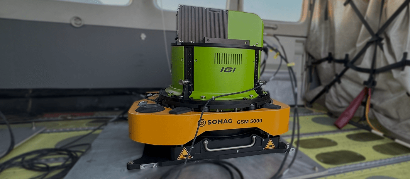
      A highlight of our exhibition is the GSM 5000, a high-performance Gyro Stabilization Mount for airborne applications. Developed for modern aerial data acquisition platforms, the GSM 5000 combines cutting-edge stabilization technology with robust engineering to ensure maximum accuracy for cameras, LiDAR, and other airborne sensors.

      Meet Our Experts at Intergeo 2026

      Our team will be on site to discuss your project requirements and help you find the ideal stabilization solution for your mission.

      We look forward to welcoming you at Intergeo 2026 in Munich.
      Andreas Steps
      CEO
      Phone: +49 3641 633 68 12
      E-Mail: a.steps@somag-ag.de
      Let’s connect on LinkedIn

      Sebastian Schreiber
      CTO
      Phone: +49 3641 633 68 0
      E-Mail: s.schreiber@somag-ag.de
      Let’s connect on LinkedIn

      Sören Lieske
      Sales Manager

      Phone: +49 3641 633 68 18
      E-Mail: s.lieske@somag-ag.de
      Let’s connect on LinkedIn

      Johannes Dreyer
      Support Manager

      Phone: +49 3641 633 68 17
      E-Mail: j.dreyer@somag-ag.de
      Let’s connect on LinkedIn

      Free tickets for our customers

      We offer our customers free vouchers for visiting Intergeo on all three opening days. To get your ticket please contact us at and we’ll then send you your personal voucher code via e-mail.
        Contact us

        Book an appointment with our team at the event.
        We’re looking forward to seeing you!


        Please solve the following question:

        Feature Package with every purchase

        Save more than €5,000 and level up your GSM 4000

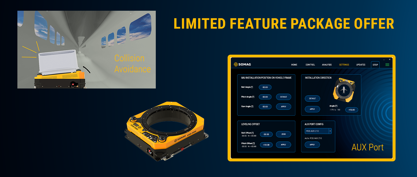
        For a short time only, every purchase of a GSM 4000 comes with a free feature package valued at over €5,000! This exclusive package includes Collision Avoidance and an AUX Port—at no additional cost. But be careful: The offer is only valid for GSM 4000 purchase orders until January 31, 2026 or while supplies last.

        Why you can profit from Collision Avoidance

        If the Mount and the sensor is installed close to the board wall inside an aircraft or if the hatch in the fuselage is narrow, the sensor system may collide with an obstacle. The Collision Avoidance feature prevents a collision of the Mount and/or the sensor system with surrounding obstacles during Mount initialization or operation. Just to name a few features:

        • Limiting the physical movement range of the Mount in all three space axes with the End Stop Limits settings
        • Selecting the side on which the Mount pumps to working height during the initialization phase, to prevent the sensor system hitting an obstacle

        Why do I need an AUX Port?

        The AUX Port interface allows you to connect an IMU directly with the Mount. The connected IMU can be easily selected and activated in the SOMAG Mount Control App. This special feature is useful if there is no FMS in the aircraft. With the AUX Port the IMU data can be read directly into the Mount. In maritime applications where a FMS is not used, such as on buoys or ships, the Feature is profitable, as external IMU data improves the residual deviation performance of the Mounts for long term applications.

        For further information please do not hesitate to contact our sales team. They will be more than happy to help you!

        We are here to help

        Sales and Support

        Sören Lieske
        Sales Manager
        Phone: +49 3641 633 68 18
        E-Mail: s.lieske@somag-ag.de
        Let’s connect on LinkedIn

        Jana Franck
        Sales Coordinator
        Phone: +49 3641 633 68 15
        E-Mail: j.franck@somag-ag.de
        Let’s connect on LinkedIn

        Newsletter

        Subscribe today!

        Keep yourself informed about SOMAG and the latest Gyro Mount technology.
        We will send you regular information about:

        • exhibitions and event invitations
        • new products, services and videos
        • latest application examples, projects and partnerships

        Subscribe here

        Subscribe to the SOMAG newsletter
        Mapping Urban Heat with Precision with SOMAG’s GSM 5000

        Leveraging next-gen sensor stabilization to support IGI in mapping urban heat.

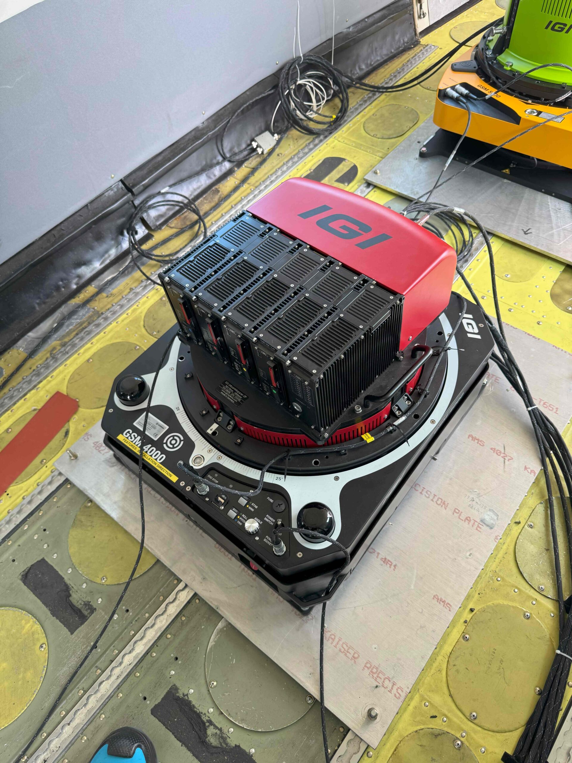
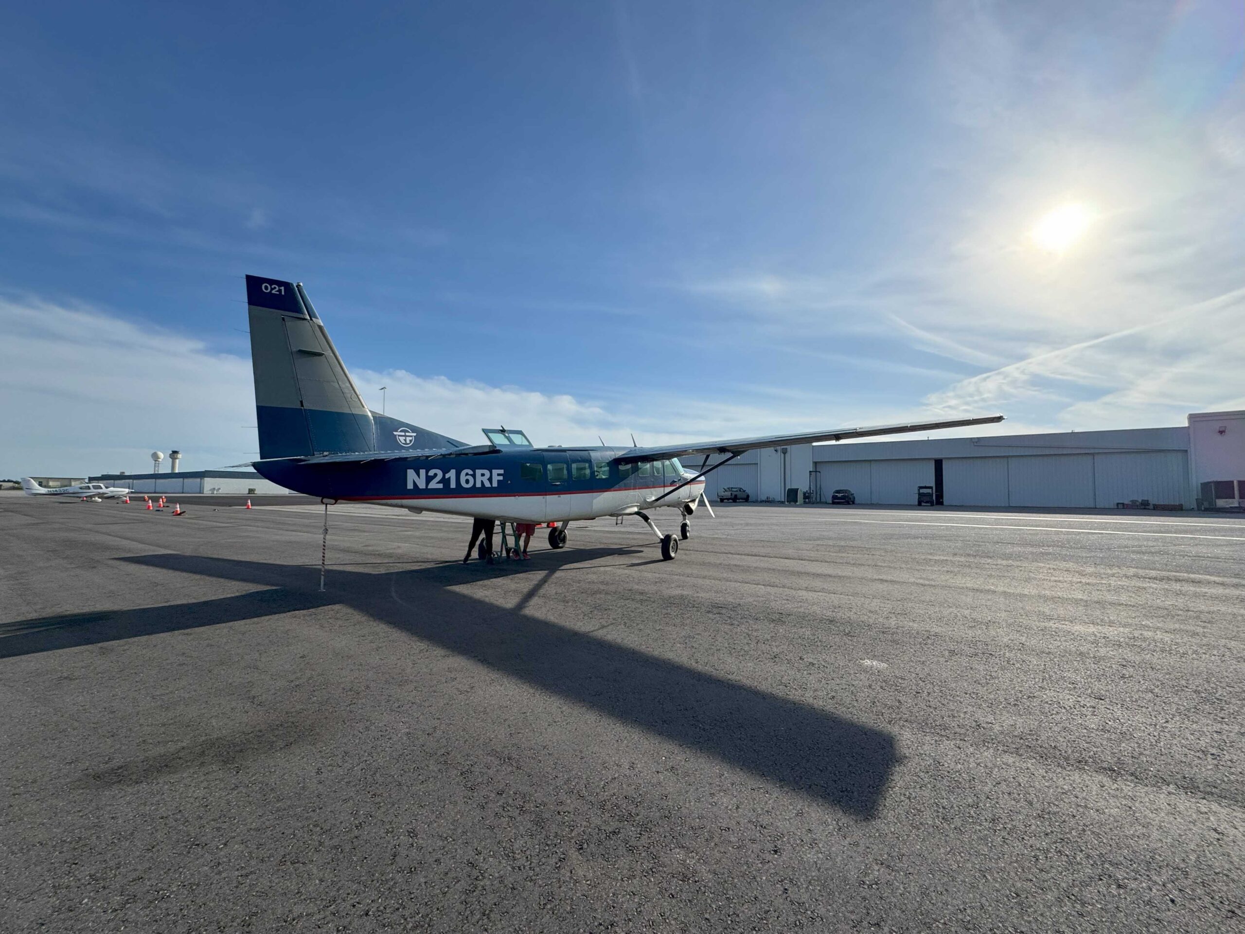
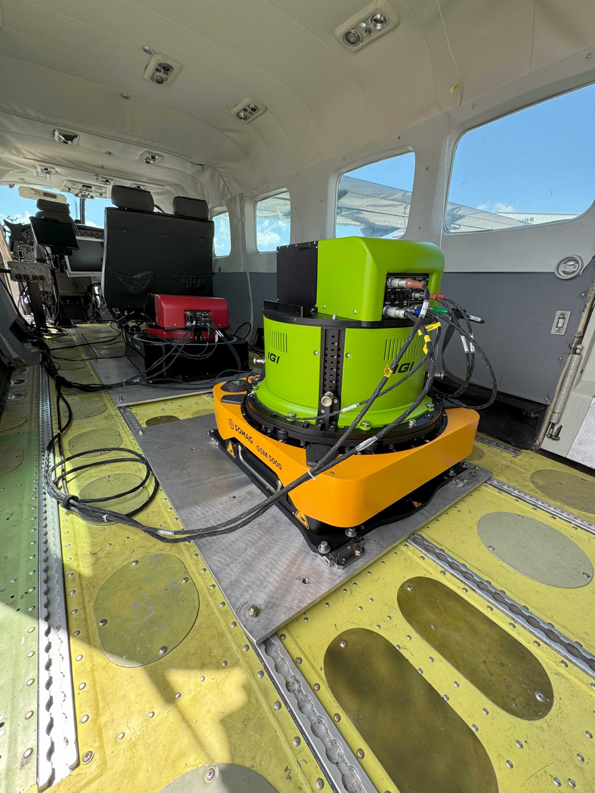
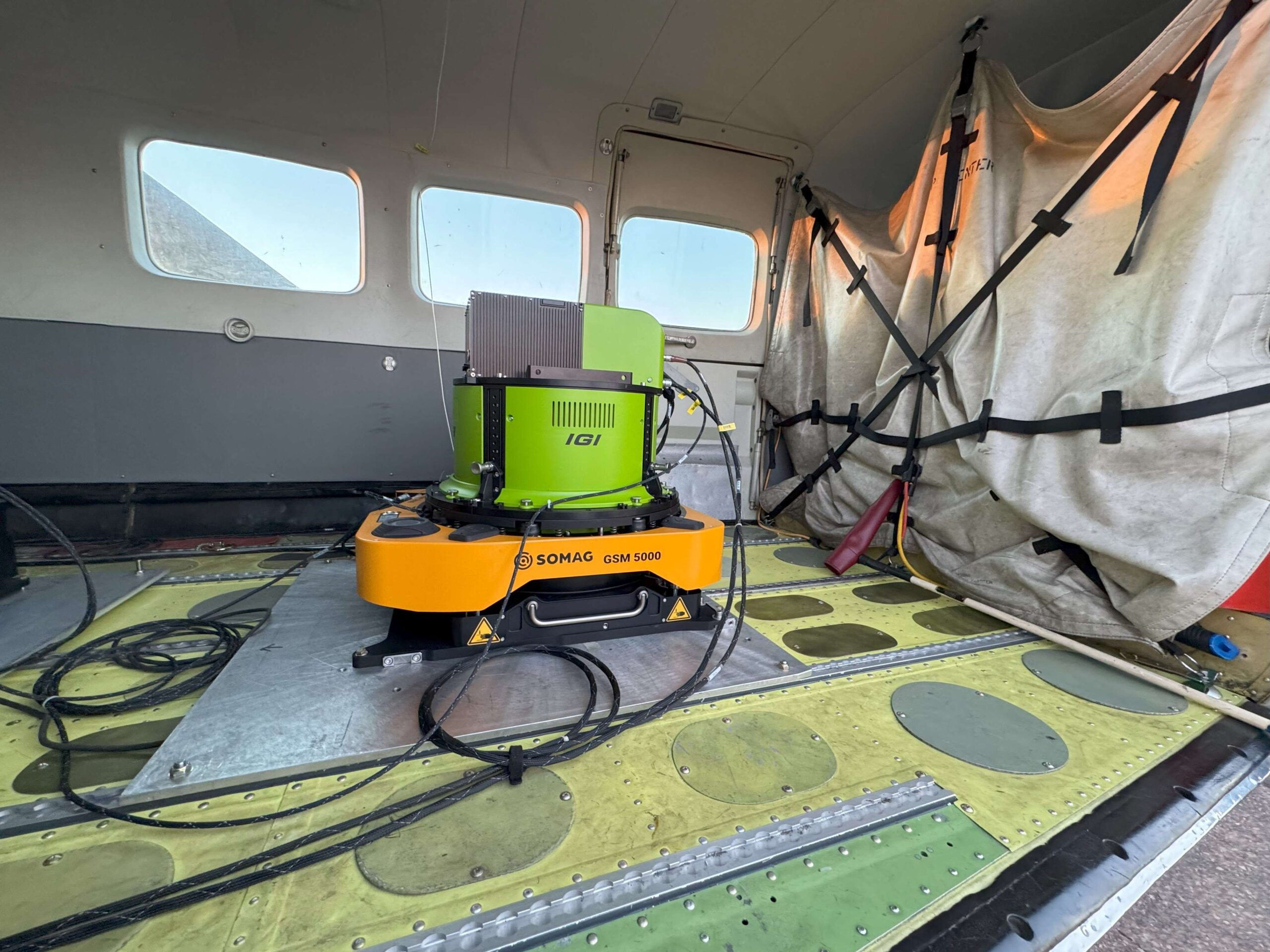
        In May 2025, SOMAG AG Jena helped conducting a challenging thermal imaging mission over Phoenix, Arizona, as part of the IGI Lighthouse Project — a collaborative initiative to promote advanced 3D and thermal mapping in the US. The mission relied on our latest gyro stabilization platform, the GSM 5000 stabilizing IGI’s EcoMapper-1280 C thermal sensor. Other companies involved in the project were: ESRI, FugroRevolution Flight and InfraTec. Despite difficult flight conditions, the Gyro Mount delivered precise and stable results, showcasing its unique capabilities in real-world, high-stress environments.

        Stable Thermal Data – Even in Harsh Flight Conditions

        Phoenix is one of the hottest major cities in North America. The Phoenix operation took place under challenging thermal conditions — midday flights in strong updrafts, combined with high external temperatures and unstable air masses. Capturing consistent thermal imagery from the air is demanding – but critical for identifying urban heat hotspots that support climate resilience and urban planning. During the mission, two independent systems were deployed:

        While both systems performed well, the GSM 5000’s superior stability under turbulence made it the standout solution of the entire mission.

        GSM 5000: The Game Changer in Airborne Stabilization

        Despite turbulence forcing aircraft speeds to increase beyond 180 knots in some sections, the GSM 5000 delivered rock-stable sensor alignment, ensure consistent data quality. Over 50% more flight time was required due to environmental factors, making stabilization even more critical.

        Why Customers

        Trust Somag

        “The conditions during the demo flight have been so bumpy that two experienced operators got airsick, nevertheless both mounts performed extremely well. Without the Mounts it would not have been possible to collect meaningful data.“

        Michael Müller, Product Manager at IGI – Integrated Geospatial Innovations

        From Zero to Mission-Ready in Hours

        The GSM 5000 is built for speed and simplicity. Thanks to its intuitive design and full compatibility with the GSM 4000, operators can install it in less than one hour — with no steep learning curve and no extra training required.

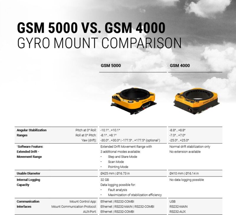
        This fast deployment is a real advantage when every hour counts. Whether under tight mission schedules or facing customs and certification hurdles, the GSM 5000 keeps things simple: same base plate, same connection points, and even less weight than its predecessor. That means fewer delays, smoother approvals, and quicker results.

        And with a lighter overall weight, larger motion range, and increased internal diameter, the GSM 5000 easily integrates larger and more complex sensors — even in aircraft with limited space.

        Design Features that proved their value

        Several key design elements of the new GSM 5000 were critical to the mission’s success:

        • Minimized risk of mechanical vignetting: The rotation center (pivot point) of the Mount is positioned near the aircraft base level to prevent mechanical vignetting (image shading caused by structural parts) in the sensor’s field of view at larger platform angles
        • Quick Deployment: All components worked in “plug & play” fashion, saving valuable field time.

        These design choices reflect SOMAG’s ongoing commitment to user feedback — an element acknowledged by the IGI team on-site. “Great that you were listening to customer feedback” commented Kamil Wójcik, Business Development Manager / Technical Sales.

        Data Analysis

        Comparison in all attitude angles

        The GSM 5000’s enhanced stabilization capabilities ensured that IGI’s EcoMapper-1280 C could operate at full potential, even under poor conditions. To highlight the stabilization improvements, we have included an interactive diagram comparing the GSM4000 and GSM5000 during identical flight conditions.

        The data of the stabilization platforms GSM 4000 (previous model) and GSM 5000 (new product generation) were recorded during the test flight and evaluated after the flight. The upper left diagram shows a schematic of the test setup: a light aircraft equipped with a camera payload recording the ground. Any tilt or rotation of the aircraft would immediately lead to blurred or distorted imagery. Therefore, precise stabilization is essential – only with a stable platform can sensors such as cameras, LiDAR scanners, or other measurement systems deliver reliable results.

        Combat Plane Movements for sharp data

        The three diagrams on the right present the attitude angles Roll, Pitch, and Yaw over a period of 60 seconds. The blue curve (Base) illustrates the unstabilized aircraft motion, which is heavily affected by turbulence. Without stabilization, camera images would constantly be subject to motions and vibrations, making accurate surveying impossible. The white curve, representing GSM 4000, reduces the aircraft motion significantly but repeatedly reaches its limits. This is highlighted by the red markers in the diagrams, which indicate situations where the end-stop boundaries are exceeded. In these moments, the system loses its ability to hold the reference position of 0 deg. In practice, this means that captured images would become blurred or distorted, resulting in data quality degradation or unusable results.

        In contrast, the yellow curve, representing GSM 5000 demonstrates much more stable performance. Even under strong turbulence, the new platform remains within its working range and keeps the sensors close to the reference position. Movements are reliably compensated, ensuring that the recorded sensor data remains sharp and consistent.

        The significance of these differences becomes clear when looking at the RMS (root mean square) values, which we likte to keep as close as possible to 0.00 degree. In Roll, GSM 4000 achieves an RMS of 0.31 deg, while GSM 5000 reduces this to 0.14 deg. In Pitch, the RMS improves from 0.34 deg to 0.06 deg. In practice, this means that even the smallest motion, which would directly appear in sensor imagery, are considerably minimized.

        Pin sharp images without exceeding the endstop

        The lower left diagram shows the horizontal plane (Roll vs. Pitch) with the endstop boundaries indicated by dashed lines. These boundaries represent the mechanical working limits of the stabilization platform. It is evident that the GSM 4000 data (white points) exceed these limits multiple times – once the system reaches this state, it can no longer stabilize the aircraft effectively. GSM 5000 (yellow points), however, consistently remains within the boundaries, guaranteeing continuous stabilization throughout the flight. This is of critical importance, since any loss of stabilization directly influences image quality and measurement accuracy.

        Results at a Glance: Why GSM 5000 Sets the Standard

        In summary, the results clearly demonstrate that the GSM 5000 raises gyro stabilization to a new level. While GSM 4000 reaches its limits under turbulent conditions, GSM 5000 retains full control of the aircraft’s motion.

        For airborne survey missions, this means that cameras and other sensors deliver significantly sharper, more consistent, and more precise data, even when flight conditions are challenging. In practice, this translates into higher operational reliability, improved image quality, and more dependable data evaluation within tougher environment.

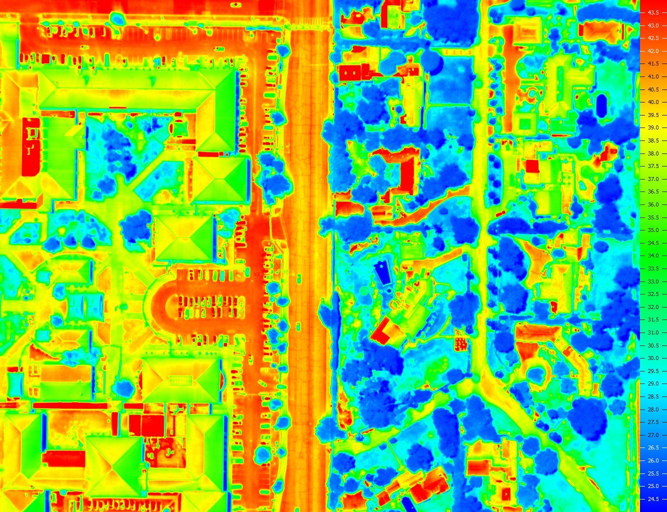
        The right image is a great example. Thermal hot spots stand out clearly against cooler zones. Areas marked in blue represent colder regions, such as shaded areas beneath trees. In sharp contrast, the hotter zones — marked in red — include features like car parks.

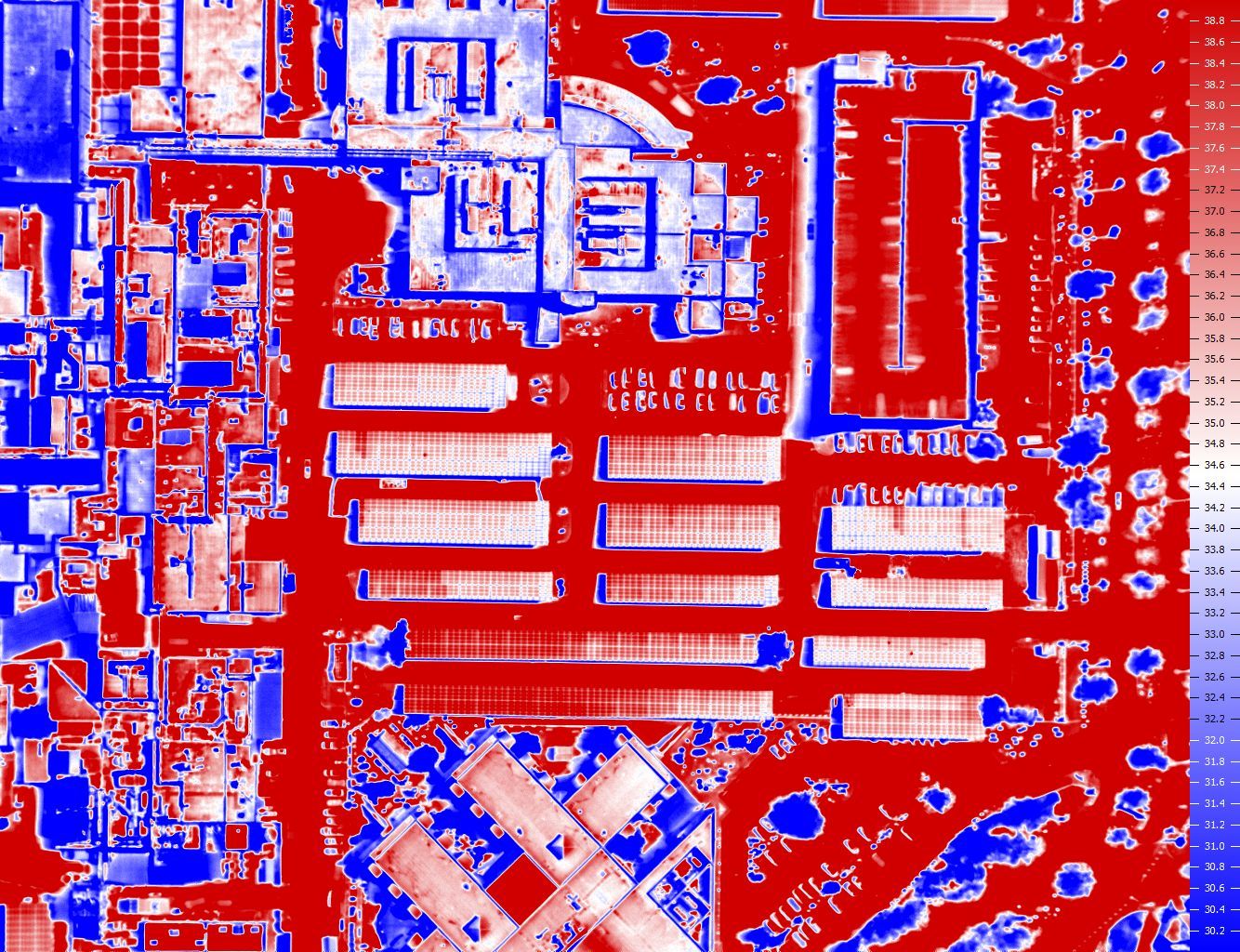
        The image on the left shows a square with solar panels. Working panels appear in paler shades, such as white or light red. Non working ones stand out, as they appear in dark red, which also indicate a thermal hotspots. The trees as well as green areas, by contrast, appear blue and are considerably cooler.

        Stability Evolved

        Choose the GSM 5000

        The GSM 5000 has proven itself as a versatile, future-ready solution for demanding airborne projects. Whether integrating cutting-edge thermal sensors, expanding corridor mapping capacity, or simply upgrading from earlier mounts, the GSM 5000 offers unmatched performance and ease of use.

        Download here the product datasheet – including a full comparison between the GSM 5000 and its predecessor, the GSM 4000.

        Data sheet GSM 5000

        Newsletter

        Subscribe today!

        Keep yourself informed about SOMAG and the latest Gyro Mount technology.
        We will send you regular information about:

        • exhibitions and event invitations
        • new products, services and videos
        • latest application examples, projects and partnerships

        Subscribe here

        Subscribe to the SOMAG newsletter

        Your camera. Our gimbal. Your lead.

        SOMAG AG Jena will participate in the 6th edition of the Open Day Photogrammetry at the Dortmund Airport in Germany on September 9 and 10, 2025. As a leading manufacturer of high-precision gyro stabilization systems, we develop gimbals that optimize data acquisition across airborne, land-based, and marine applications. In photogrammetry, where image clarity and geospatial accuracy are essential, our stabilization technology plays a crucial role in reducing motion blur and improving the quality of captured data. Our solutions are used worldwide by system integrators, mapping professionals, and survey organizations to increase efficiency and data reliability.

        Our CEO Andreas Steps is looking forward to meet you at this special branch event and welcoming you at our booth, where we will be showcasing our airborne mounts, designed specifically for demanding aerial survey missions. Whether you are working with cameras, LiDAR, or other remote sensing equipment, our gimbals offer the performance and flexibility needed for high-quality results. Come by and talk to us — we’re happy to discuss your application needs.

        MEET OUR EXPERT

        Andreas Steps
        CEO
        Phone: +49 3641 633 68 12
        E-Mail: a.steps@somag-ag.de
        Let’s connect on LinkedIn

          Contact us

          Book an appointment with our team at the event.
          We’re looking forward to seeing you!


          Please solve the following question: