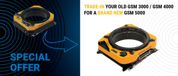
Ready for GSM 5000? Trade Up!
Trade in your GSM 3000 or 4000 for the all-new GSM 5000 – the future of aerial stabilization – and enjoy savings of up to €15,000 with our exclusive trade-in program. With GSM 4000 production discontinued and only a limited number of units remaining, now is the perfect time to make the switch.
more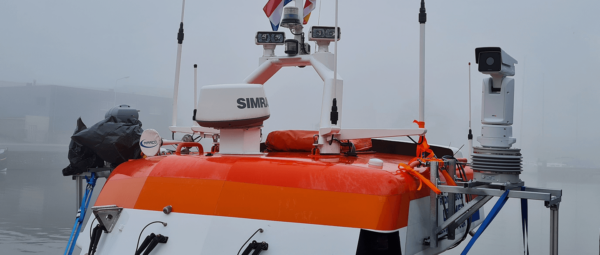
RSM 50 Marine Gyro Stabilizer Excels in SAR Mission Test
Discover how the RSM 50 Marine Gyro Stabilizer Mount excels in real-world rescue scenarios. This Ruggedized Gyro Stabilization Mount ensures precise camera stabilizing for SAR missions.
more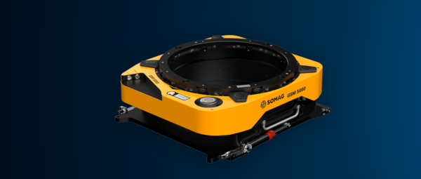
SOMAG launches Gyro Stabilization Mount GSM 5000
SOMAG AG Jena is excited to announce the official launch of the GSM 5000, live from Intergeo 2024.
more
GSM 5000 Launch at Intergeo 2024
Join SOMAG for the grand reveal of the GSM 5000 at Intergeo 2024 and get an exclusive first look at the future of Airborne Gyro Stabilization Mounts.
more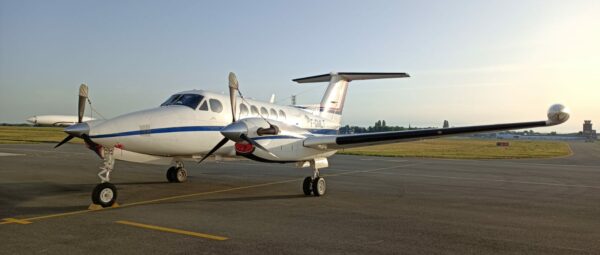
LiDAR system and aerial camera stabilized by GSM 4000
The LiDAR HD program, initiated by IGN, aims to revolutionize national territory mapping through innovative approaches. Tasks encompass acquiring airborne LiDAR data, processing to meet specifications, and automatic classification using a Deep…
more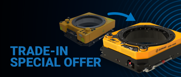
Special GSM 3000 Trade-In offer
Upgrade to the latest GSM 4000 with our exclusive trade-in program for the GSM 3000 and save up to 15,000 Euros. With support for the GSM 3000 ending on January 1, 2025, now is the perfect time to make the switch and ensure your equipment remains cutting-edge.
more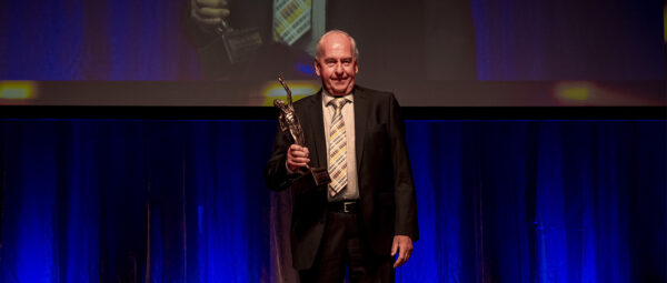
SOMAG AG Jena Wins Award
SOMAG AG Jena was awarded the prestigious "Großer Preis des Mittelstandes" on September 16, 2023. Konrad Steps accepted the award for his life's work at the award ceremony in Würzburg.
more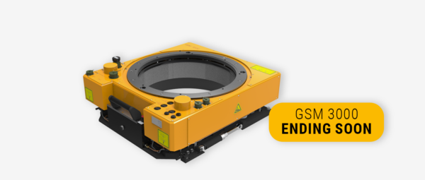
GSM 3000 End of Life
In December 2024 the support period of GSM 3000 ends. This means that from 01.01.2025 we no longer offer maintenance and repair for GSM 3000.
more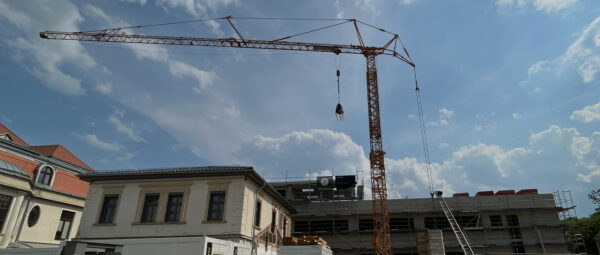
Topping-out ceremony at SOMAG
On 22.05.2023, SOMAG AG Jena celebrated the topping-out ceremony in the completed shell of the new company building. With the expansion of the space, the company lays the foundation for personnel growth.
more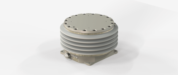
NSM 500 Launch
SOMAG AG Jena announces the launch of the new NSM 500, a medium-sized gimbal for sensor stabilization in mobile land and water applications.
more
Multi-sensor aerial system stabilized by GSM 4000
Cooper Aerial Surveys Co. uses a multi-sensor aerial imaging system stabilized by our GSM 4000 Gyro Stabilization Mount to capture high-density LiDAR and high-resolution imagery. Read more about how this system helped create a flood study across Nye County in this case study.
more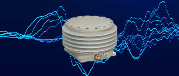
Vibration Test
SOMAG AG Jena has successfully completed vibration tests on its Nautical Gyro Stabilization Mount NSM 400.
more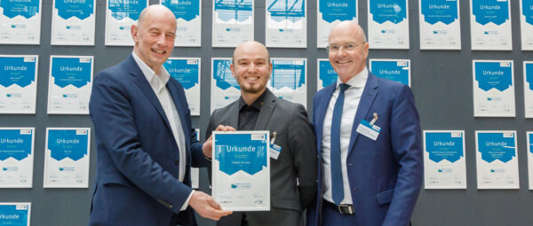
SOMAG AG Jena awarded
SOMAG AG Jena was awarded as Hidden Champion - Thuringian world market & technology leader.
more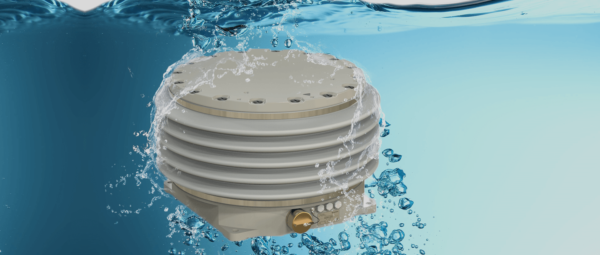
IP 67 test
SOMAG AG Jena has successfully tested the IP rating of its Gyro Stabilization Mounts for marine and land applications.
more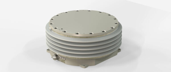
OSM 5000 launch
SOMAG AG Jena announces the launch of the new OSM 5000, the most powerful Gyro Stabilization Mount ever developed by SOMAG.
more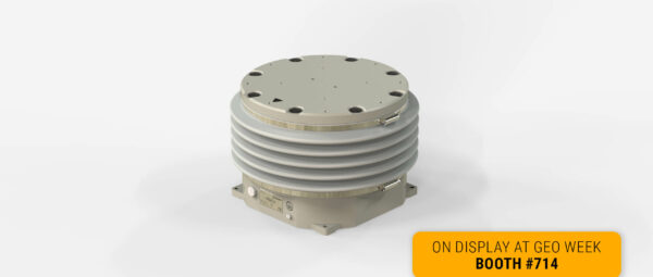
RSM 50 launch
SOMAG AG Jena announces the launch of the new RSM 50, a compact and cost-effective gimbal that offers top-notch stabilization in offroad and offshore environments.
more
SOMAG Mount Control App 5.1.0 release
SOMAG AG Jena is launching a new version (5.1.0) of the SOMAG Mount Control App, a software tool that simplifies the operation and configuration of its Gyro Stabilization Mounts.
more
Gyro Mounts Temperature Tests
SOMAG AG Jena has successfully completed temperature tests on its airborne, marine and land Gyro Stabilization Mounts at the independent and accredited test laboratory MeßTechnikNord GmbH in Jena, Germany.
more
Dual GSM 4000 Application
95West revolutionizes simultaneous data collection with a dual GSM 4000 setup. Discover in this customer success story why the US-company chose our GSM 4000 as their preferred Gyro Stabilization Mount.
more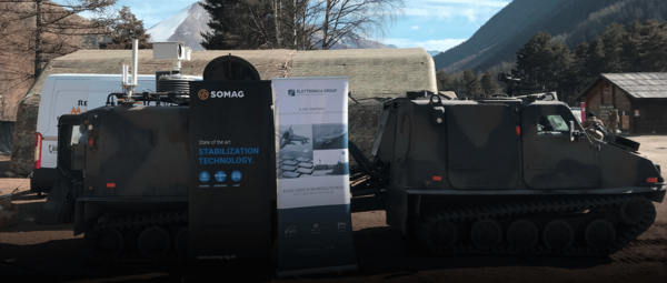
NSM 400 - Land Application
The NSM 400 - Land was presented as part of ELETTRONICA GROUP'S advanced Snow Leopard anti-drone system during a NATO exercise in early March in Sestriere, Italy.
more
20th Anniversary Discount
We are celebrating 20 years of SOMAG and the launch of our new corporate design. To share this special moment with our customers, we have prepared a great offer.
more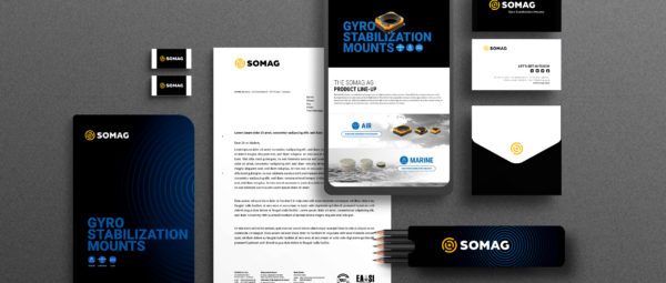
Corporate Design Launch
SOMAG AG Jena officially unveils its new corporate design including a new logo and a brand new website.
more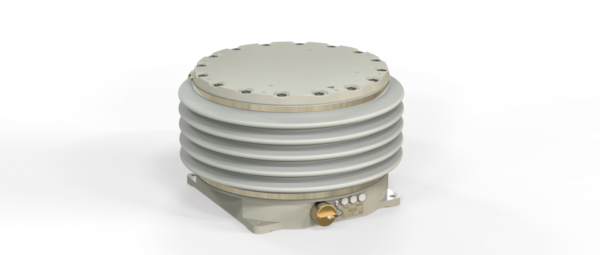
NSM 400 Performance Test
SOMAG AG Jena has successfully tested the stabilization performance of its Nautical Stabilization Mount 400 at the Institute of Ship Technology and Transport Systems, University of Duisburg-Essen.
moreNSM 400 Launch
SOMAG AG Jena launched the NSM 400 - a marine Gyro Stabilization Mount for offshore stabilization of Eo/IR and surveillance sensor systems and payloads.
more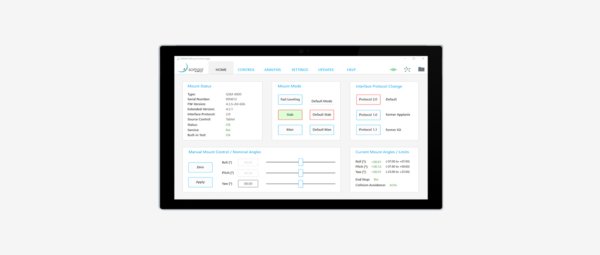
Revised Software Features
On the occasion of this year's Intergeo, SOMAG AG Jena presents its newly revised software features to align them even more closely with customer needs.
more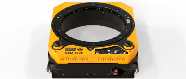
Survey with GSM 4000
Green Rebel Group recently purchased a Gyro Stabilization Mount GSM 4000 for aerial ecology surveys.
more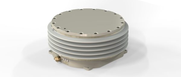
Gyro Mount for Wind LiDAR Stabilization
SOMAG AG Jena has announced that it has won a public tender to supply Centrale Nantes with a stabilization system for their scanning wind LiDAR.
moreAUX Port for GSM 4000
We would like to draw your attention to a technical innovation for one of our devices. The Aux Port interface is now also available for our GSM 4000. All our airborne as well as all marine and land Mounts offer this feature now.
moreSubscribe today!
Keep yourself informed about SOMAG and the latest Gyro Mount technology.
We will send you regular information about:
- exhibitions and event invitations
- new products, services and videos
- latest application examples, projects and partnerships